Wednesday, July 19
Returning, Day 4
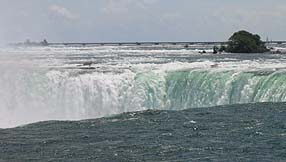
Niagara Falls
|
|
|
|
When I got back from seeing the Falls, and started downloading the photos, I couldn't believe it when it said there were 68 of them. But it's true, I took 68 pictures of the Falls. Naturally I will only show the best ones on this page... but how the heck can I choose? I spread the pics over today's page and yesterday's page too, since it had no pics; so take the "previous day" arrow to see the rest of the Falls pics.
First a few words about the Falls.
From waaay back, before the dinosaurs, before the Ice Age, an elevated plain existed which had an escarpment falling to the land below. This escarpment is very long, extending from New York State through Canada to Wisconsin. During the Ice Age, this escarpnment was covered with a huge glacier like everything else in the region.
 When the glaciers melted, vast lakes formed from the meltwater, which drained away to the South and East. One of them was where what is now the Niagara River crossed the escarpment, in a modest waterfall. With the removal of the glacier's weight, the land rebounded upward and the various outlets for the glacial lakes were closed, leaving only Niagara to convey all the outflow of all the lakes -- and at that time, they were far, far larger than the current Great Lakes.
 The hugely increased volume of water flowing over the little falls started cutting the escarpment rock back, slowly eating it away into a gorge through which the Niagara River runs. Niagara Falls represents the current location of the eroding edge of the escarpment -- 7 miles away from where it began.
 Before the hydroelectric plants were built, Niagara Falls was moving upstream at the rate of 1 foot per year. Hydroelectric power has removed 30% of the water from the river above the Falls, and the effect was to greatly slow the rate of erosion. The Falls are now moving at a rate of 1 foot per 10 years.
|
|
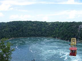
An interesting feature of the river below the Falls is a large circular pool where whirlpools form, where the river makes a right-angle turn.
While the Falls was downstream from this area, the river ran straight over the top of it. When the Falls in its slow movement upstream reached this area and eroded off the top cap layer of rock, it exposed an ancient river gorge that had become filled with glacial rubble. This rubble had little resistance to the water's force -- and the Whirlpool was created in a lightning fast 6 weeks. It must have been a wild and wooly 6 weeks, with landslides crashing down every day. The river's current course, with the right-angle turn at the Whirlpool, represents its following the course of the ancient buried river gorge once it was exposed.
|
|
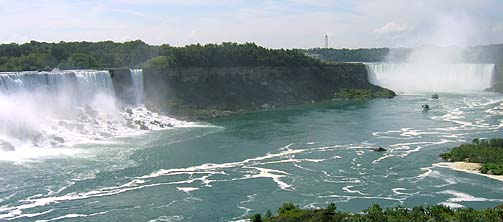
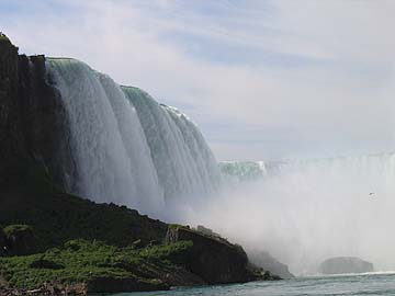
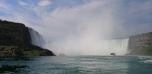
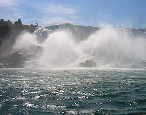
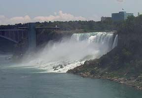
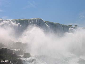
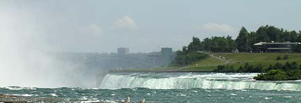
The Falls is currently divided by an island into 2 separate falls, American Falls and Horseshoe Falls.
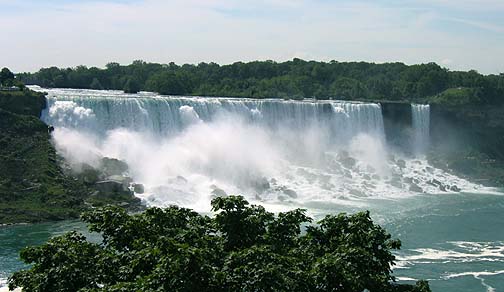
 American Falls has a large talus slope of huge boulder rubble, where the falling water explodes into spume. Nobody tries to go over this falls in a barrel; it would mean instant death on the rocks below.
|
|
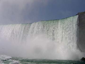
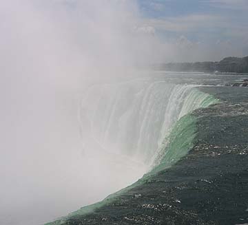
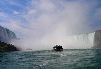
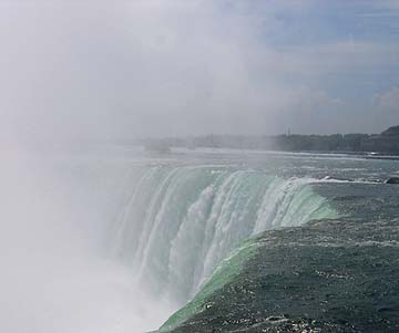
Horseshoe Falls is the larger fall, with the larger volume of water, and falls straight down into a deep pool below.
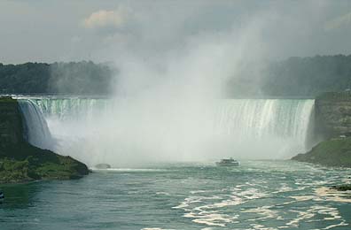
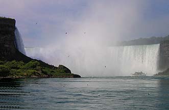
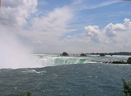 The island marks the boundary between the US and Canada, so Horseshoe Falls is on Canadian soil. You get by far the best view of the falls from the Canadian side, so I am over here for the visit.
 ' '
|
|
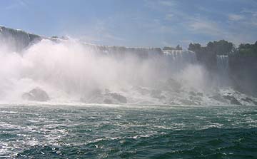
Above the Falls, the river is full of boulders.
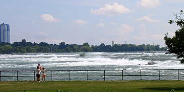 Wonder why they haven't washed over? Before hydroelectric power, when the entire water volume went over the Falls, the boulders were not so evident. After 30% of the water was removed not only were the boulders exposed, but the Falls did not run with water over their entire width. An elaborate system of water gates was created to divert the water so that it covered the same width it did before, albeit at a more shallow depth, to preserve the beauty of the Falls.
|
|
|
|
The river is lined with a lovely park on the Canadian side, all the way from Lake to Lake.
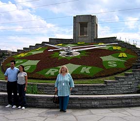 One of the clever features is the Flower Clock. It is redesigned each year, following a design competition. That's me standing in front of it, pic taken by tour guide. This is what I look like after having been soaked to the skin twice and then dried twice without recourse to iron or curlers. One thing about Niagara; if you are below the falls on the Maid of the Mist, or above the falls looking down at it, you will get drenched. It was very difficult to take pictures without getting the camera lens covered with water -- and indeed, several pictures were ruined unless you like that underwater look.
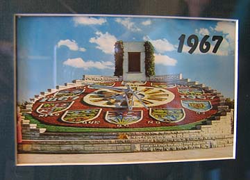
This year's clock is not so impressive, in my eyes; but get a look at the 1967 version of the Clock! Stunning.
There are many public gardens etc along this park and I would love to see them, but not this visit -- I've been away from home too long already.
|
|
|


 .
.